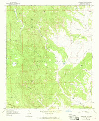
1965 Map of Underwood Lake
USGS Topo · Published 1968About this map
Apache National Forest dominates this mid-1960s landscape, where high-altitude peaks and mesa landforms meet a complex system of water management. The terrain is defined by prominent summits such as Jim Smith Peak and Bishop Peak, while the lower elevations reveal a reliance on dispersed water sources like Smith Tank, Karruth Tank, and Knowlton Tank. The presence of the Cinder Pit near Red Butte suggests localized extractive activity amidst the timber and grazing lands.
Find a feature on this map
45 named features on this map. Tap any name to fly to it.
Don’t see what you’re looking for? This feature index may not catch every label — zoom into the map to look around manually.
Map Details
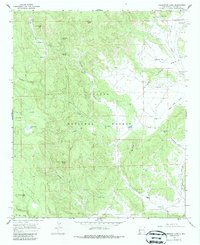
Editions of this 1965 Underwood Lake Map
2 editions found
Other maps of this area

1886 · St Johns
USGS Topo · 1:250,000

1892 · St Johns
USGS Topo · 1:250,000

1915 · Reserve
USGS Topo · 1:125,000

1918 · Reserve
USGS Topo · 1:125,000

1922 · Nutrioso
USGS Topo · 1:125,000

1954 · Clifton
USGS Topo · 1:250,000

1954 · Saint Johns
USGS Topo · 1:250,000

1957 · Clifton
USGS Topo · 1:250,000

1957 · Saint Johns
USGS Topo · 1:250,000

1958 · Clifton
USGS Topo · 1:250,000