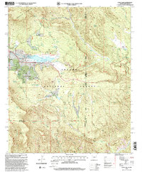
1997 Map of Luna Lake
USGS Topo · Published 2000About this map
Alpine sits at the center of this high-elevation landscape, where the headwaters of the San Francisco River and the Blue River originate in the heart of the Apache National Forest. This late-twentieth-century revision illustrates the community's development through features like the Alpine Country Club and the Mobile Home Park, while maintaining its rural character with the Double J Ranch and a local Cemetery. The topography is dominated by the southern slopes of Escudilla Mountain and the prominent Juniper Bench to the south.
Find a feature on this map
36 named features on this map. Tap any name to fly to it.
Don’t see what you’re looking for? This feature index may not catch every label — zoom into the map to look around manually.
Map Details
Editions of this 1997 Luna Lake Map
This is the sole edition of this map. No revisions or reprints were ever made.
Other maps of this area

1915 · Reserve
USGS Topo · 1:125,000

1918 · Reserve
USGS Topo · 1:125,000

1922 · Nutrioso
USGS Topo · 1:125,000

1954 · Clifton
USGS Topo · 1:250,000

1957 · Clifton
USGS Topo · 1:250,000

1958 · Clifton
USGS Topo · 1:250,000

1958 · Alpine
USGS Topo · 1:62,500

1961 · Blue
USGS Topo · 1:62,500

1962 · Clifton
USGS Topo · 1:250,000
1965 · Underwood Lake
USGS Topo · 1:24,000