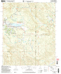
2005 Map of Luna Lake
USGS Topo · Published 2006About this map
The settlement of Alpine serves as the focal point for this high-country landscape, positioned near the headwaters of the San Francisco River and surrounded by the Apache National Forest. This 2005 revision highlights the local recreation and infrastructure supporting the community, including the Alpine Country Club, a Mobile Home Park, and the Luna Lake Group campground. To the north, the slopes of Escudilla Mountain overlook a complex network of springs and tanks like Skousen Spring and Terry Tank Spg, essential for ranching and wildlife in this semi-arid terrain. The border with New Mexico and the transition to the Gila National Forest create a distinct administrative landscape where forest roads like 271 and 2310 connect isolated landmarks such as the Double J Ranch and Tenney Pond. Water management remains a primary theme throughout, evidenced by the Lower Cienega Reservoir and numerous named ciénegas.
Find a feature on this map
112 named features on this map. Tap any name to fly to it.
Don’t see what you’re looking for? This feature index may not catch every label — zoom into the map to look around manually.
Map Details
Editions of this 2005 Luna Lake Map
This is the sole edition of this map. No revisions or reprints were ever made.
Other maps of this area

1915 · Reserve
USGS Topo · 1:125,000

1918 · Reserve
USGS Topo · 1:125,000

1922 · Nutrioso
USGS Topo · 1:125,000

1954 · Clifton
USGS Topo · 1:250,000

1957 · Clifton
USGS Topo · 1:250,000

1958 · Clifton
USGS Topo · 1:250,000

1958 · Alpine
USGS Topo · 1:62,500

1961 · Blue
USGS Topo · 1:62,500

1962 · Clifton
USGS Topo · 1:250,000
1965 · Underwood Lake
USGS Topo · 1:24,000