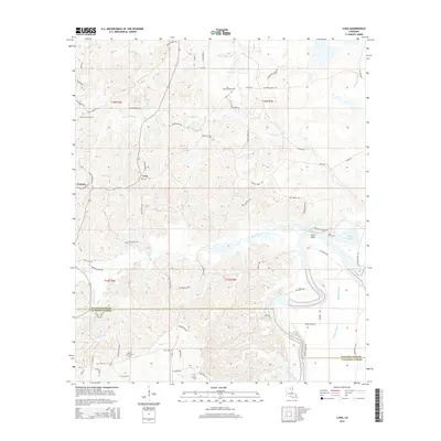
2015 Map of Luna
USGS Topo · Published 2015About this map
Cypress and Luna sit within a landscape defined by the shifting waters of the Ouachita River and its intricate network of bayous and creeks. This 2015 study shows the rural character of the region as it transitions across the Ouachita Parish and Caldwell Parish line. The eastern edge is dominated by riverine features such as the Coco Bend and Cutoff Bayou, while the interior is crisscrossed by waterways like Prairion Bayou and Cypress Creek. For those tracing local heritage, the map identifies several rural burying grounds including Pine Grove Cem, Saint Pauls Cem, and Furlow Cem. The road network, often bearing family names like Charles Rawls Rd and Ted Williamson Rd, reflects a pattern of long-standing land ownership and small-scale community hubs scattered throughout the piney lowlands.
Find a feature on this map
82 named features on this map. Tap any name to fly to it.
Don’t see what you’re looking for? This feature index may not catch every label — zoom into the map to look around manually.
Map Details
Editions of this 2015 Luna Map
This is the sole edition of this map. No revisions or reprints were ever made.
Other maps of this area

1940 · Monroe
USGS Topo · 1:62,500

1940 · Columbia
USGS Topo · 1:62,500

1953 · Chatham
USGS Topo · 1:62,500

1954 · Sikes
USGS Topo · 1:62,500

1955 · Shreveport
USGS Topo · 1:250,000

1956 · Shreveport
USGS Topo · 1:250,000

1957 · Columbia
USGS Topo · 1:62,500

1957 · West Monroe South
USGS Topo · 1:24,000

1957 · Monroe South
USGS Topo · 1:24,000

1957 · Monroe South
USGS Topo · 1:62,500