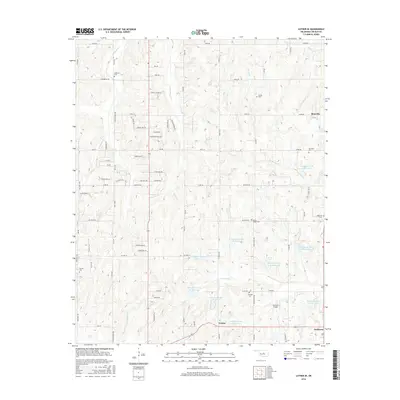
2016 Map of Luther SE
USGS Topo · Published 2016About this map
Quapaw Cr and its numerous flood-control reservoirs dominate this landscape along the border of Oklahoma and Lincoln Counties. The terrain is defined by a dense network of small tributaries including Wildhorse Cr, Spring Cr, and the East and West forks of Captain Cr, flowing through a region where section-line roads like E0980 Rd and NE 63rd St organize the rural homesteads. Small settlements such as Rossville, Fowler, and Jacktown anchor the local community, while the presence of several family or community burial grounds, including the Newby, Jamison, and Ferrell cemeteries, provides significant detail for genealogical research. The southern portion of the map features the Jacktown Airport and the intersection of modern routes near the Lincoln County line, illustrating the area's continued role as a crossroads for local aviation and transit.
Find a feature on this map
56 named features on this map. Tap any name to fly to it.
Don’t see what you’re looking for? This feature index may not catch every label — zoom into the map to look around manually.
Map Details
Editions of this 2016 Luther SE Map
This is the sole edition of this map. No revisions or reprints were ever made.
Other maps of this area

1896 · Seminole and Prague
USGS Topo · 1:125,000

1898 · Purcell
USGS Topo · 1:125,000

1905 · Chandler
USGS Topo · 1:62,500

1907 · Chandler
USGS Topo · 1:62,500

1909 · Shawnee
USGS Topo · 1:62,500

1909 · Luther
USGS Topo · 1:62,500

1930 · McLoud
USGS Topo · 1:62,500

1954 · Oklahoma City
USGS Topo · 1:250,000

1956 · Harrah
USGS Topo · 1:24,000

1956 · Horseshoe Lake
USGS Topo · 1:24,000