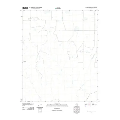
2010 Map of Luttrell Springs
USGS Topo · Published 2010About this map
Horseshoe Canyon and the surrounding drainage network of the Salt Fork define the topography of this Armstrong County landscape. The area is characterized by a sparse rural road system and a complex web of intermittent watercourses that have carved deep into the Texas Panhandle terrain. Small farm-to-market and county roads such as Fm 1258, Oscar Rd, and Papa Rd provide the primary access to these ranchlands, tracing a grid across the uplands between the creek beds.
Find a feature on this map
15 named features on this map. Tap any name to fly to it.
Don’t see what you’re looking for? This feature index may not catch every label — zoom into the map to look around manually.
Map Details
Editions of this 2010 Luttrell Springs Map
This is the sole edition of this map. No revisions or reprints were ever made.
Other maps of this area

1954 · Amarillo
USGS Topo · 1:250,000

1954 · Plainview
USGS Topo · 1:250,000

1958 · Amarillo
USGS Topo · 1:250,000

1958 · Plainview
USGS Topo · 1:250,000

1960 · Fairview
USGS Topo · 1:24,000

1960 · Claude
USGS Topo · 1:62,500

1960 · Wayside
USGS Topo · 1:62,500

1963 · Luttrell Springs
USGS Topo · 1:24,000

1963 · Luttrell Springs NE
USGS Topo · 1:24,000

1963 · Pleasant Creek
USGS Topo · 1:24,000