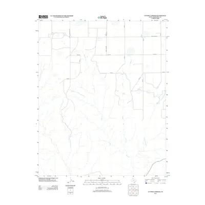
2012 Map of Luttrell Springs
USGS Topo · Published 2012About this map
Luttrell Springs and the headwaters of the Salt Fork define this portion of the Texas Panhandle in Armstrong County. The landscape is characterized by a network of drainage systems, including Little Arkansas Cr and Dripping Springs Cr, which carve through the high plains toward the southeast. These water sources, including the isolated Dripping Spring, were essential markers for early cattle ranching operations in this region. The map shows a transition toward modern infrastructure with a grid of rural routes such as Ranch Road 1258 and Ranch Road 3330 cutting across the terrain, while smaller tracks like Oscar Rd and Papa Rd provide access to the interior sections of the large ranches that still dominate the local economy.
Find a feature on this map
18 named features on this map. Tap any name to fly to it.
Don’t see what you’re looking for? This feature index may not catch every label — zoom into the map to look around manually.
Map Details
Editions of this 2012 Luttrell Springs Map
This is the sole edition of this map. No revisions or reprints were ever made.
Other maps of this area

1954 · Amarillo
USGS Topo · 1:250,000

1954 · Plainview
USGS Topo · 1:250,000

1958 · Amarillo
USGS Topo · 1:250,000

1958 · Plainview
USGS Topo · 1:250,000

1960 · Fairview
USGS Topo · 1:24,000

1960 · Claude
USGS Topo · 1:62,500

1960 · Wayside
USGS Topo · 1:62,500

1963 · Luttrell Springs
USGS Topo · 1:24,000

1963 · Luttrell Springs NE
USGS Topo · 1:24,000

1963 · Pleasant Creek
USGS Topo · 1:24,000