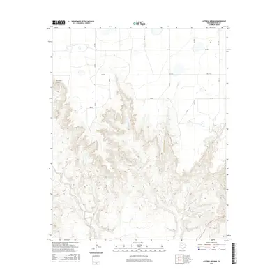
2016 Map of Luttrell Springs
USGS Topo · Published 2016About this map
Luttrell Springs serves as a vital water point in this high-plains landscape of Armstrong County, where the topography abruptly drops from flat agricultural lands into a complex system of breaks and canyons. The Salt Fork and its tributaries, including Luttrell Cr and Little Arkansas Cr, have carved deep incisions into the earth, creating prominent landforms like Horseshoe Canyon. This 2016 survey illustrates the contrast between the organized grid of county roads such as Oscar Rd and Papa Rd on the caprock and the meandering, natural drainage patterns below the rim. Local water sources remain central to the geography of the area, evidenced by features like Dripping Spring and its associated creek. The map reflects a modern rural Texas landscape where ranch roads and state routes like FM 1258 provide the primary access to these remote canyonlands.
Find a feature on this map
17 named features on this map. Tap any name to fly to it.
Don’t see what you’re looking for? This feature index may not catch every label — zoom into the map to look around manually.
Map Details
Editions of this 2016 Luttrell Springs Map
This is the sole edition of this map. No revisions or reprints were ever made.
Other maps of this area

1954 · Amarillo
USGS Topo · 1:250,000

1954 · Plainview
USGS Topo · 1:250,000

1958 · Amarillo
USGS Topo · 1:250,000

1958 · Plainview
USGS Topo · 1:250,000

1960 · Fairview
USGS Topo · 1:24,000

1960 · Claude
USGS Topo · 1:62,500

1960 · Wayside
USGS Topo · 1:62,500

1963 · Luttrell Springs
USGS Topo · 1:24,000

1963 · Luttrell Springs NE
USGS Topo · 1:24,000

1963 · Pleasant Creek
USGS Topo · 1:24,000