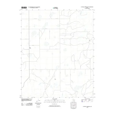
2010 Map of Luttrell Springs NE
USGS Topo · Published 2010About this map
Mulberry Creek and its seasonal tributaries carve a network of drainage patterns across this High Plains landscape in Armstrong County. The terrain is defined by a grid of rural routes, including November Rd, Papa Rd, and Quebec Rd, which serve the scattered ranching and agricultural operations of the region. A notable point of interest for local historians is the Mount Pleasant Cemetery, situated near the western edge of the map, providing a genealogical anchor for the surrounding community. Small-scale infrastructure like Reed Airport and the isolated settlement at Jacks Camp reflect the low-density land use of the Texas Panhandle. The southern portion of the area is drained by Coyote Creek and Gip Creek, which feed into the larger riparian system as the elevation drops toward the rolling plains.
Find a feature on this map
16 named features on this map. Tap any name to fly to it.
Don’t see what you’re looking for? This feature index may not catch every label — zoom into the map to look around manually.
Map Details
Editions of this 2010 Luttrell Springs NE Map
This is the sole edition of this map. No revisions or reprints were ever made.
Other maps of this area

1954 · Amarillo
USGS Topo · 1:250,000

1954 · Plainview
USGS Topo · 1:250,000

1958 · Amarillo
USGS Topo · 1:250,000

1958 · Plainview
USGS Topo · 1:250,000

1960 · Claude
USGS Topo · 1:62,500

1960 · Groom
USGS Topo · 1:62,500

1963 · Blue Hole Springs
USGS Topo · 1:24,000

1963 · Luttrell Springs
USGS Topo · 1:24,000

1963 · Luttrell Springs NE
USGS Topo · 1:24,000

1963 · Paloduro
USGS Topo · 1:24,000