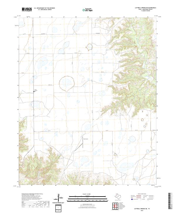
2022 Map of Luttrell Springs NE
USGS Topo · Published 2022About this map
Mount Pleasant Cem and the small airfield of Reed Airport sit atop the high plains of the Texas Panhandle in this portion of Armstrong County. The landscape is defined by the sharp transition between level agricultural tablelands and the deeply carved drainage systems of the eastern Caprock Escarpment. Watercourses like Mulberry Cr, Coyote Cr, and Gip Cr have eroded the plateau into a complex network of canyons and breaks, creating a distinct topographical boundary that runs north to south through the quadrangle. A grid of rural roads, including November Rd and Oscar Rd, provides access across the flat upland plains to the west, while the eastern breaks remain largely inaccessible by road, preserving the natural erosion patterns of the Mulberry Creek drainage.
Find a feature on this map
18 named features on this map. Tap any name to fly to it.
Don’t see what you’re looking for? This feature index may not catch every label — zoom into the map to look around manually.
Map Details
Editions of this 2022 Luttrell Springs NE Map
This is the sole edition of this map. No revisions or reprints were ever made.
Other maps of this area

1954 · Amarillo
USGS Topo · 1:250,000

1954 · Plainview
USGS Topo · 1:250,000

1958 · Amarillo
USGS Topo · 1:250,000

1958 · Plainview
USGS Topo · 1:250,000

1960 · Claude
USGS Topo · 1:62,500

1960 · Groom
USGS Topo · 1:62,500

1963 · Blue Hole Springs
USGS Topo · 1:24,000

1963 · Luttrell Springs
USGS Topo · 1:24,000

1963 · Luttrell Springs NE
USGS Topo · 1:24,000

1963 · Paloduro
USGS Topo · 1:24,000