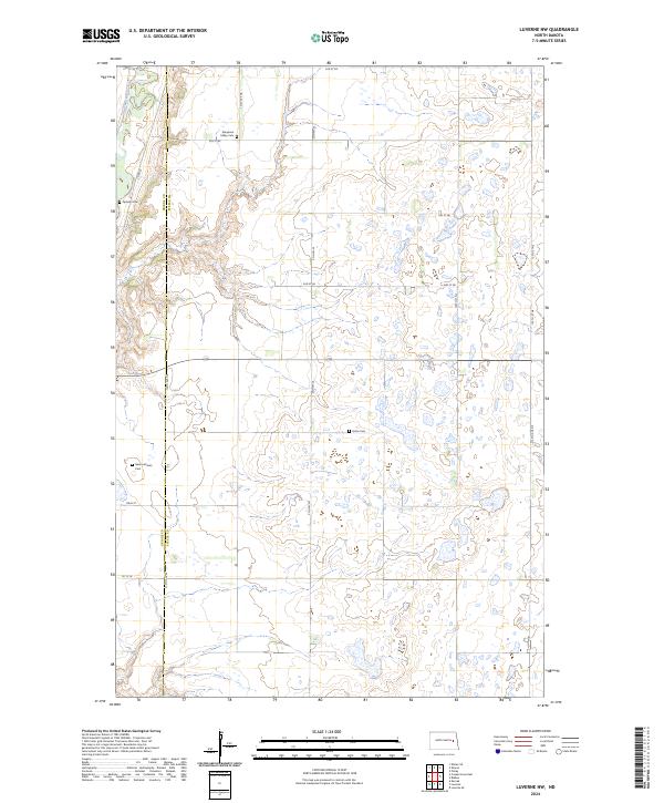
2024 Map of Luverne NW
USGS Topo · Published 2024About this map
The Sheyenne River cuts through the northwest corner of this region, creating a distinct topographical break from the surrounding plateau. This landscape is defined by the boundary between Griggs Co and Steele Co, where the rural infrastructure of townships T146N and T145N is laid out in a precise grid. The placement of several burial grounds, including Sheyenne Valley Cem and Opheim Cem, suggests the locations of long-standing community centers in this agricultural district. Further south, Hofva Cem and Ness Lutheran Cem serve as quiet landmarks among the section lines and small wetlands. The road network, including Co Hwy 25 and Main St, provides the primary framework for the scattered farmsteads that characterize this part of North Dakota.
Find a feature on this map
24 named features on this map. Tap any name to fly to it.
Don’t see what you’re looking for? This feature index may not catch every label — zoom into the map to look around manually.
Map Details
Editions of this 2024 Luverne NW Map
This is the sole edition of this map. No revisions or reprints were ever made.
Other maps of this area

1952 · Grand Forks
USGS Topo · 1:250,000

1952 · New Rockford
USGS Topo · 1:250,000

1956 · New Rockford
USGS Topo · 1:250,000

1956 · Grand Forks
USGS Topo · 1:250,000

1961 · Cooperstown East
USGS Topo · 1:24,000

1961 · Karnak
USGS Topo · 1:24,000

1966 · Grand Forks
USGS Topo · 1:250,000

1967 · Blabon
USGS Topo · 1:24,000
1967 · Kloten SE
USGS Topo · 1:24,000

1967 · Finley
USGS Topo · 1:24,000