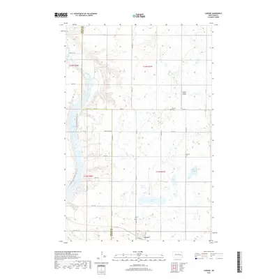
2018 Map of Luverne
USGS Topo · Published 2018About this map
Luverne anchors the southern edge of this Steele County landscape, where the prairie grid is interrupted by the winding course of the Sheyenne River. The river valley, which forms the western boundary of the township, is partially flooded by the northern reaches of Lake Ashtabula, a significant water feature that defines the local topography. Along the eastern bluffs of the river, the N Country National Scenic Trail provides a continuous path through the terrain, passing near several local landmarks.
Find a feature on this map
33 named features on this map. Tap any name to fly to it.
Don’t see what you’re looking for? This feature index may not catch every label — zoom into the map to look around manually.
Map Details
Editions of this 2018 Luverne Map
This is the sole edition of this map. No revisions or reprints were ever made.
Other maps of this area

1952 · Grand Forks
USGS Topo · 1:250,000

1952 · New Rockford
USGS Topo · 1:250,000

1956 · New Rockford
USGS Topo · 1:250,000

1956 · Grand Forks
USGS Topo · 1:250,000

1961 · Cooperstown East
USGS Topo · 1:24,000

1961 · Dazey NE
USGS Topo · 1:24,000

1961 · Karnak
USGS Topo · 1:24,000

1966 · Grand Forks
USGS Topo · 1:250,000

1967 · Blabon
USGS Topo · 1:24,000
1967 · Luverne
USGS Topo · 1:24,000