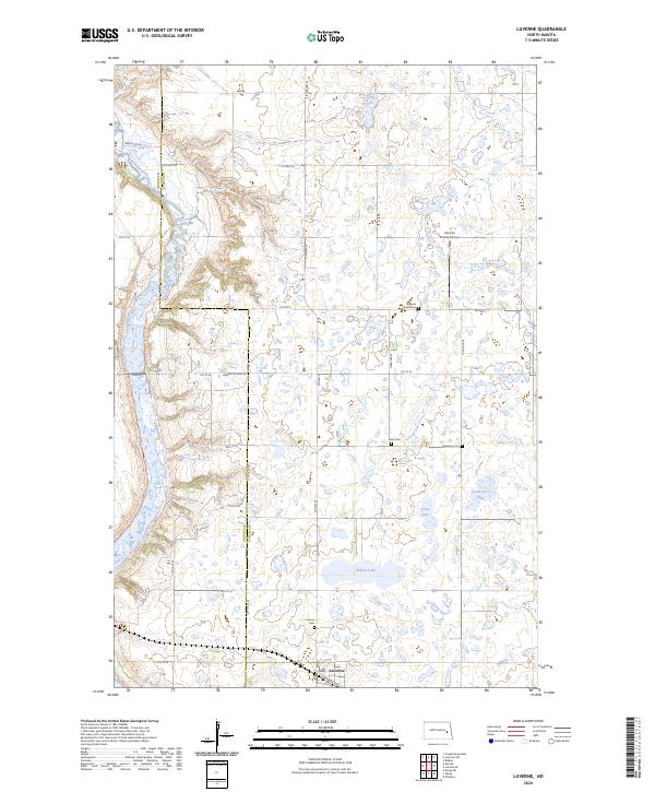
2024 Map of Luverne
USGS Topo · Published 2024About this map
The Luverne townsite sits at the southern edge of this landscape, where Railroad Ave and local routes like 10th St SE serve the surrounding agricultural community. The terrain is defined by the winding course of the Sheyenne River along the western boundary and a dense concentration of prairie potholes and small lakes to the east, including Willow Lake, Stony Lake, and Lone Tree Lake. This area of Steele County preserves significant conservation land at the Steele County Waterfowl Production Area.
Find a feature on this map
32 named features on this map. Tap any name to fly to it.
Don’t see what you’re looking for? This feature index may not catch every label — zoom into the map to look around manually.
Map Details
Editions of this 2024 Luverne Map
This is the sole edition of this map. No revisions or reprints were ever made.
Other maps of this area

1952 · Grand Forks
USGS Topo · 1:250,000

1952 · New Rockford
USGS Topo · 1:250,000

1956 · New Rockford
USGS Topo · 1:250,000

1956 · Grand Forks
USGS Topo · 1:250,000

1961 · Cooperstown East
USGS Topo · 1:24,000

1961 · Dazey NE
USGS Topo · 1:24,000

1961 · Karnak
USGS Topo · 1:24,000

1966 · Grand Forks
USGS Topo · 1:250,000

1967 · Blabon
USGS Topo · 1:24,000
1967 · Luverne
USGS Topo · 1:24,000