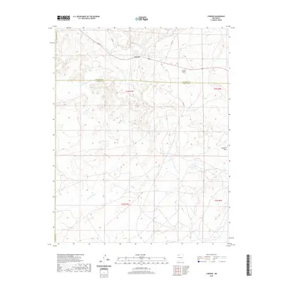
2020 Map of Lybrook
USGS Topo · Published 2020About this map
Lybrook sits at the northern edge of this high-desert landscape, where the arid drainages of the San Juan Basin carve a complex network of arroyos and canyons. The terrain is defined by significant hydrological features like Blanco Wash and Escavada Wash, which channel seasonal runoff through the shifting sands of the region. To the east, the rising landforms of Sisnathyel Mesa and Escrito Canyon create a sharp contrast to the broader washes below. The presence of Escrito Spring near the settlement highlights the critical importance of water sources in this dry corridor. The map clearly delineates the border between Rio Arriba and Sandoval counties, showing how local infrastructure like Atkins Rd and Co RD 377 connects these remote outposts. This detailed survey captures the essential character of the Four Corners region, illustrating the relationship between ancient geological formations and modern navigation.
Find a feature on this map
18 named features on this map. Tap any name to fly to it.
Don’t see what you’re looking for? This feature index may not catch every label — zoom into the map to look around manually.
Map Details
Editions of this 2020 Lybrook Map
This is the sole edition of this map. No revisions or reprints were ever made.
Other maps of this area

1889 · Largo
USGS Topo · 1:250,000

1895 · Largo
USGS Topo · 1:250,000

1954 · Aztec
USGS Topo · 1:250,000

1958 · Aztec
USGS Topo · 1:250,000

1959 · Nageezi
USGS Topo · 1:62,500

1962 · Aztec
USGS Topo · 1:250,000

1963 · Tayfoya Canyon
USGS Topo · 1:24,000

1965 · Aztec
USGS Topo · 1:250,000

1966 · Lybrook NW
USGS Topo · 1:24,000
1966 · Mule Dam
USGS Topo · 1:24,000