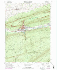
1969 Map of Lykens
USGS Topo · Published 1977About this map
The ridge-and-valley terrain of central Pennsylvania dominates this landscape, where the coal-mining heritage of the northern Dauphin County anthracite region is clearly visible. Parallel ridges of Short Mountain, Big Lick Mountain, and Berry Mountain frame the settled valleys of Wiconisco Creek. The industrial footprint is evident in the strip mines scarring the slopes and the large Tailings Pond located near the borough of Lykens.
Find a feature on this map
59 named features on this map. Tap any name to fly to it.
Don’t see what you’re looking for? This feature index may not catch every label — zoom into the map to look around manually.
Map Details
Editions of this 1969 Lykens Map
4 editions found
Other maps of this area

1892 · Lykens
USGS Topo · 1:62,500

1892 · Hummelstown
USGS Topo · 1:62,500

1892 · Harrisburg
USGS Topo · 1:62,500

1893 · Lykens
USGS Topo · 1:62,500

1893 · Millersburg
USGS Topo · 1:62,500

1899 · Harrisburg
USGS Topo · 1:62,500

1924 · Hummelstown
USGS Topo · 1:62,500

1924 · Harrisburg
USGS Topo · 1:62,500

1943 · Millersburg
USGS Topo · 1:62,500

1943 · Lykens
USGS Topo · 1:62,500