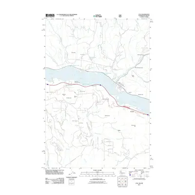
2011 Map of Lyle
USGS Topo · Published 2011About this map
The Columbia River divides the landscape of this 2011 survey, marking the boundary between Washington and Oregon. On the northern shore, the settlement of Lyle sits at the confluence where the Klickitat River joins the main channel, flanked by landmarks like Indian Point and the waters of Chamberlain Lake. This area is characterized by dramatic elevation changes, moving from the riverbanks up to Rocky Flat and the high vantage of the Memaloose Overlook.
Find a feature on this map
82 named features on this map. Tap any name to fly to it.
Don’t see what you’re looking for? This feature index may not catch every label — zoom into the map to look around manually.
Map Details
Editions of this 2011 Lyle Map
This is the sole edition of this map. No revisions or reprints were ever made.
Other maps of this area

1934 · The Dalles
USGS Topo · 1:125,000

1953 · The Dalles
USGS Topo · 1:250,000

1956 · The Dalles
USGS Topo · 1:250,000

1957 · The Dalles
USGS Topo · 1:250,000

1957 · Klickitat
USGS Topo · 1:62,500

1957 · The Dalles
USGS Topo · 1:62,500

1957 · White Salmon
USGS Topo · 1:62,500

1957 · Husum
USGS Topo · 1:62,500

1974 · The Dalles North
USGS Topo · 1:24,000
1974 · Brown Creek
USGS Topo · 1:24,000