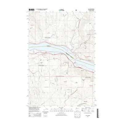
2014 Map of Lyle
USGS Topo · Published 2014About this map
The Columbia River forms a wide natural corridor separating the Gifford Pinchot National Forest in Washington from the Mount Hood National Forest in Oregon. This 2014 survey captures the distinct settlement patterns along the river banks, with the town of Lyle situated near the mouth of the Klickitat River and the community of Rowena tucked under the cliffs on the southern shore. The topography is dominated by dramatic elevation changes, from the basalt heights of McClure Hill and Rowena Crest to the riverside flats near Salisbury Slough.
Find a feature on this map
92 named features on this map. Tap any name to fly to it.
Don’t see what you’re looking for? This feature index may not catch every label — zoom into the map to look around manually.
Map Details
Editions of this 2014 Lyle Map
This is the sole edition of this map. No revisions or reprints were ever made.
Other maps of this area

1934 · The Dalles
USGS Topo · 1:125,000

1953 · The Dalles
USGS Topo · 1:250,000

1956 · The Dalles
USGS Topo · 1:250,000

1957 · The Dalles
USGS Topo · 1:250,000

1957 · Klickitat
USGS Topo · 1:62,500

1957 · The Dalles
USGS Topo · 1:62,500

1957 · White Salmon
USGS Topo · 1:62,500

1957 · Husum
USGS Topo · 1:62,500

1974 · The Dalles North
USGS Topo · 1:24,000
1974 · Brown Creek
USGS Topo · 1:24,000