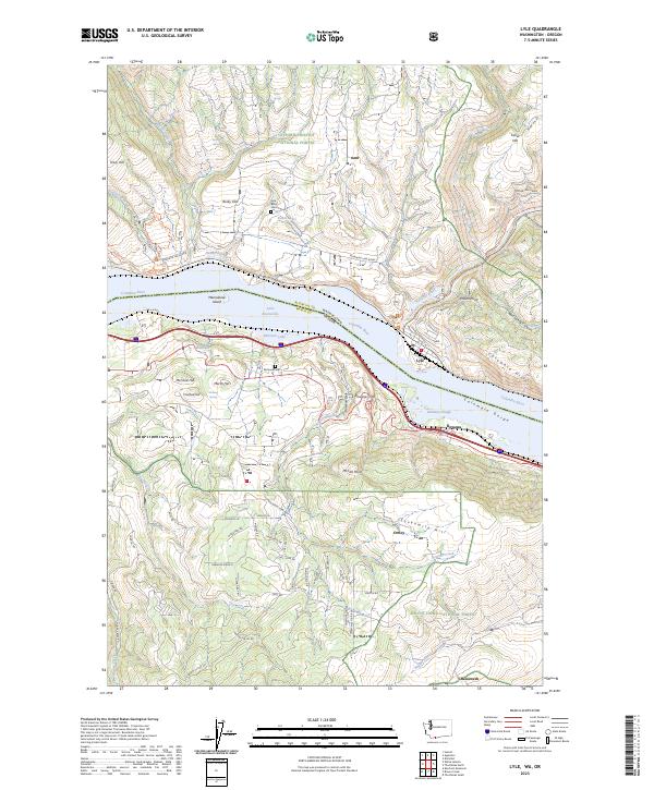
2023 Map of Lyle
USGS Topo · Published 2023About this map
The Columbia River forms a dramatic central axis here, separating the town of Lyle in Washington from Rowena and Ortley on the Oregon side. This river corridor, dominated by the waters of Lake Bonneville, shows a landscape defined by steep elevation changes, from the basalt cliffs of the Columbia Gorge to high points like McCall Point and Sevenmile Hill. The confluence of the Klickitat River near Lyle serves as a major geographical marker, with the Klickitat Wild and Scenic River corridor winding through the northeastern section.
Find a feature on this map
81 named features on this map. Tap any name to fly to it.
Don’t see what you’re looking for? This feature index may not catch every label — zoom into the map to look around manually.
Map Details
Editions of this 2023 Lyle Map
This is the sole edition of this map. No revisions or reprints were ever made.
Other maps of this area

1934 · The Dalles
USGS Topo · 1:125,000

1953 · The Dalles
USGS Topo · 1:250,000

1956 · The Dalles
USGS Topo · 1:250,000

1957 · The Dalles
USGS Topo · 1:250,000

1957 · Klickitat
USGS Topo · 1:62,500

1957 · The Dalles
USGS Topo · 1:62,500

1957 · White Salmon
USGS Topo · 1:62,500

1957 · Husum
USGS Topo · 1:62,500

1974 · The Dalles North
USGS Topo · 1:24,000
1974 · Brown Creek
USGS Topo · 1:24,000