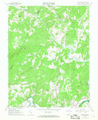
1966 Map of Lynch Station
USGS Topo · Published 1968About this map
Lynch Station and the neighboring community of Evington serve as the primary hubs in this mid-1960s survey of southern Campbell County. The landscape is defined by the convergence of major transportation and water routes, including the Southern railroad corridor and the winding course of the Big Otter River. The map provides significant detail for genealogists, identifying numerous rural sanctuaries such as Bethlehem Ch, Mt Pisgah Ch, and St Pauls Ch. The topography rises toward Johnson Mountain in the west, where a Radio Tower (WLVA) stands as a modern landmark. In the south, the Norfolk and Western railway follows the banks of the Roanoke River as it marks the border with Pittsylvania County. This era of the landscape features a mix of traditional agriculture and burgeoning infrastructure, evidenced by scattered mines and the Radio Facility near Haden Mountain.
Find a feature on this map
45 named features on this map. Tap any name to fly to it.
Don’t see what you’re looking for? This feature index may not catch every label — zoom into the map to look around manually.
Map Details
Editions of this 1966 Lynch Station Map
4 editions found
Other maps of this area

1892 · Lynchburg
USGS Topo · 1:125,000

1944 · Lynchburg
USGS Topo · 1:62,500

1947 · Roanoke
USGS Topo · 1:250,000

1950 · Goode
USGS Topo · 1:62,500

1950 · Lynchburg
USGS Topo · 1:62,500

1951 · Altavista
USGS Topo · 1:62,500

1956 · Gladys
USGS Topo · 1:62,500

1959 · Roanoke
USGS Topo · 1:250,000

1963 · Roanoke
USGS Topo · 1:250,000

1963 · City Farm
USGS Topo · 1:24,000