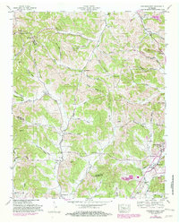
1949 Map of Lynchburg West
USGS Topo · Published 1982About this map
Lynchburg serves as the focal point of this mid-century landscape, positioned near the intersection of several local waterways including Mulberry Creek and Price Branch. The map reveals a deeply etched topography of ridges and namesake hollows, such as Possumtrot Hollow and Polecat Hollow, where small settlements and family farms once thrived. Significant local history is preserved through the numerous documented burial sites, including the New Herman Cem and Motlow Cem, alongside rural landmarks like Ward Cave.
Find a feature on this map
68 named features on this map. Tap any name to fly to it.
Don’t see what you’re looking for? This feature index may not catch every label — zoom into the map to look around manually.
Map Details
Editions of this 1949 Lynchburg West Map
2 editions found
Other maps of this area

1936 · Booneville
USGS Topo · 1:24,000

1936 · Shelbyville
USGS Topo · 1:24,000

1936 · Cumberland Springs
USGS Topo · 1:24,000

1936 · Belleville
USGS Topo · 1:24,000

1936 · Bedford
USGS Topo · 1:24,000

1936 · Mulberry
USGS Topo · 1:24,000

1936 · Normandy
USGS Topo · 1:24,000

1936 · Fayetteville
USGS Topo · 1:24,000

1936 · Lois
USGS Topo · 1:24,000

1941 · Cumberland Springs
USGS Topo · 1:24,000