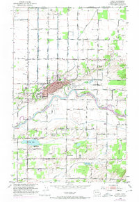
1952 Map of Lynden
USGS Topo · Published 1974About this map
Lynden sits at the heart of this North Cascades foothills landscape, positioned along the northern bank of the Nooksack River. The map reveals a highly developed agricultural and transport network, with the Chicago Milwaukee St Paul and Pacific railroad cutting through the town center. To the south, the terrain is defined by a series of glacial lakes including Wiser Lake, Fountain Lake, and Green Lake, with the small community of Bartlett Beach offering a localized settlement point.
Find a feature on this map
43 named features on this map. Tap any name to fly to it.
Don’t see what you’re looking for? This feature index may not catch every label — zoom into the map to look around manually.
Map Details
Editions of this 1952 Lynden Map
3 editions found
Other maps of this area

1906 · Sumas
USGS Topo · 1:62,500

1907 · Blaine
USGS Topo · 1:62,500

1908 · Sumas
USGS Topo · 1:62,500

1952 · Bertrand Creek
USGS Topo · 1:24,000

1952 · Lynden
USGS Topo · 1:24,000

1952 · Lawrence
USGS Topo · 1:24,000

1952 · Sumas
USGS Topo · 1:24,000

1952 · Ferndale
USGS Topo · 1:24,000

1952 · Blaine
USGS Topo · 1:62,500

1954 · Bellingham North
USGS Topo · 1:24,000