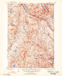
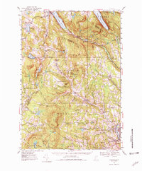
1951 Map of Lyndonville
USGS Topo · Published 1951About this map
Lake Willoughby and Crystal Lake dominate the northern terrain of this Vermont landscape, where the Canadian Pacific railroad cuts through the glacial valleys of the Northeast Kingdom. The 1951 revision shows a deeply established network of rural education and community life, with several small schoolhouses like Old Red Sch and Sherburne Sch serving the uplands of Wheelock and Sheffield. In the southeast, the village of Lyndonville serves as a regional hub, home to Lyndon Teachers College and a central Lyndon Cemetery.
Find a feature on this map
107 named features on this map. Tap any name to fly to it.
Don’t see what you’re looking for? This feature index may not catch every label — zoom into the map to look around manually.
Map Details
Editions of this 1951 Lyndonville Map
5 editions found
Other maps of this area

1919 · Lake Memphremagog
USGS Topo · 1:62,500

1920 · Derby
USGS Topo · 1:62,500

1920 · Irasburg
USGS Topo · 1:62,500

1923 · Irasburg
USGS Topo · 1:48,000

1923 · Lake Memphremagog
USGS Topo · 1:48,000

1924 · Island Pond
USGS Topo · 1:48,000

1925 · Irasburg
USGS Topo · 1:62,500

1925 · Memphremagog
USGS Topo · 1:62,500

1926 · Island Pond
USGS Topo · 1:62,500

1928 · Hardwick
USGS Topo · 1:62,500