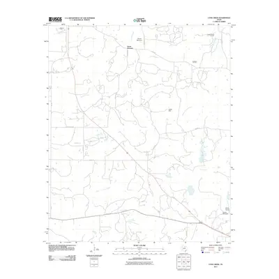
2011 Map of Lynn Creek
USGS Topo · Published 2011About this map
Lynn Creek and its complex network of seasonal tributaries define the cattle and oil country of central Jack County. The terrain is marked by distinctive elevations like Squaw Mountain in the north and Round Mountain in the southeast, providing a rugged backdrop for local ranching and energy extraction. The map documents the spatial relationship between legacy land use and industrial activity, specifically noting the Ellis Oil Field and McDonald Oil Field. For those researching local family history, the presence of the Roberts Branch Cemetery and Round Mountain Cemetery provides critical geographic anchors for early settlers in this part of Texas. An intricate web of county roads and farm-to-market routes, including China Ridge Rd and FM 1191, connects isolated homesteads and follows the natural drainage patterns of waterways like Cameron Creek and the Roberts Prairie Branch.
Find a feature on this map
29 named features on this map. Tap any name to fly to it.
Don’t see what you’re looking for? This feature index may not catch every label — zoom into the map to look around manually.
Map Details
Editions of this 2011 Lynn Creek Map
This is the sole edition of this map. No revisions or reprints were ever made.
Other maps of this area

1954 · Wichita Falls
USGS Topo · 1:250,000

1958 · Wichita Falls
USGS Topo · 1:250,000

1960 · Jacksboro
USGS Topo · 1:24,000

1962 · Antelope Creek NE
USGS Topo · 1:24,000

1964 · Senate
USGS Topo · 1:24,000

1964 · Johnson Lake
USGS Topo · 1:24,000

1964 · Darnell Branch
USGS Topo · 1:24,000

1964 · Bryson
USGS Topo · 1:24,000

1964 · Lynn Creek
USGS Topo · 1:24,000

1964 · Antelope
USGS Topo · 1:24,000