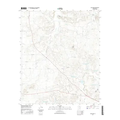
2016 Map of Lynn Creek
USGS Topo · Published 2016About this map
Squaw Mtn and Indian Hills define the upland terrain of this north-central Texas landscape, where modern resource management meets old family landmarks. The drainage network is dense with tributaries like Lynn Creek, Cameron Cr, and Roberts Branch, many of which feed into a series of flood-control projects such as Soil Conservation Service Site 16 Reservoir. These reservoirs reflect the mid-to-late 20th-century effort to stabilize the Texas watershed against erosion and seasonal flooding.
Find a feature on this map
33 named features on this map. Tap any name to fly to it.
Don’t see what you’re looking for? This feature index may not catch every label — zoom into the map to look around manually.
Map Details
Editions of this 2016 Lynn Creek Map
This is the sole edition of this map. No revisions or reprints were ever made.
Other maps of this area

1954 · Wichita Falls
USGS Topo · 1:250,000

1958 · Wichita Falls
USGS Topo · 1:250,000

1960 · Jacksboro
USGS Topo · 1:24,000

1962 · Antelope Creek NE
USGS Topo · 1:24,000

1964 · Senate
USGS Topo · 1:24,000

1964 · Johnson Lake
USGS Topo · 1:24,000

1964 · Darnell Branch
USGS Topo · 1:24,000

1964 · Bryson
USGS Topo · 1:24,000

1964 · Lynn Creek
USGS Topo · 1:24,000

1964 · Antelope
USGS Topo · 1:24,000