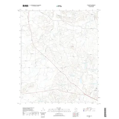
2019 Map of Lynn Creek
USGS Topo · Published 2019About this map
Roberts Branch Cem and Round Mountain Cem mark the long-standing family foundations of this Jack County landscape, where small-scale ranching and water management define the rural character. The terrain is shaped by the drainage of Lynn Cr and Cameron Cr, supplemented by numerous water projects such as Soil Conservation Service Site 15 Reservoir and Soil Conservation Service Site 31 Reservoir. These sites represent the critical infrastructure required to manage the watershed in north-central Texas. Prominent elevations like Squaw Mtn and Round Mtn overlook a network of country roads including China Ridge RD and Roney RD, which connect remote homesteads and ranch lands. The map illustrates a contemporary rural environment where historical burial grounds remain preserved amidst modern conservation efforts and traditional cattle country.
Find a feature on this map
35 named features on this map. Tap any name to fly to it.
Don’t see what you’re looking for? This feature index may not catch every label — zoom into the map to look around manually.
Map Details
Editions of this 2019 Lynn Creek Map
This is the sole edition of this map. No revisions or reprints were ever made.
Other maps of this area

1954 · Wichita Falls
USGS Topo · 1:250,000

1958 · Wichita Falls
USGS Topo · 1:250,000

1960 · Jacksboro
USGS Topo · 1:24,000

1962 · Antelope Creek NE
USGS Topo · 1:24,000

1964 · Senate
USGS Topo · 1:24,000

1964 · Johnson Lake
USGS Topo · 1:24,000

1964 · Darnell Branch
USGS Topo · 1:24,000

1964 · Bryson
USGS Topo · 1:24,000

1964 · Lynn Creek
USGS Topo · 1:24,000

1964 · Antelope
USGS Topo · 1:24,000