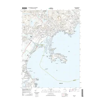
2015 Map of Lynn
USGS Topo · Published 2015About this map
Lynn and its rocky coastal surroundings define this detailed 2015 study, showcasing a densely populated shoreline from Beachmont up to the borders of Salem. The map documents a complex landscape of early burial grounds and modern infrastructure, including the Old East Burying Ground and the expansive Pine Grove Cem. A narrow peninsula stretches into the Nahant Bay, connecting the mainland to Little Nahant and the town of Nahant, where rocky landmarks like Bass Point and Spouting Horn meet the Atlantic.
Find a feature on this map
133 named features on this map. Tap any name to fly to it.
Don’t see what you’re looking for? This feature index may not catch every label — zoom into the map to look around manually.
Map Details
Editions of this 2015 Lynn Map
This is the sole edition of this map. No revisions or reprints were ever made.
Other maps of this area

1886 · Lawrence
USGS Topo · 1:62,500

1888 · Lawrence
USGS Topo · 1:62,500

1888 · Salem
USGS Topo · 1:62,500

1892 · Boston Bay
USGS Topo · 1:62,500

1893 · Salem
USGS Topo · 1:62,500

1893 · Boston
USGS Topo · 1:62,500

1893 · Lawrence
USGS Topo · 1:62,500

1903 · Boston
USGS Topo · 1:62,500

1903 · Boston Bay
USGS Topo · 1:62,500

1917 · Salem
USGS Topo · 1:62,500