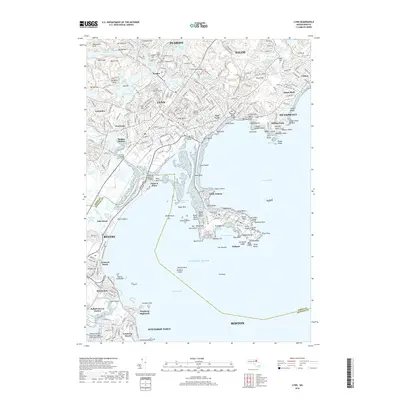
2018 Map of Lynn
USGS Topo · Published 2018About this map
Lynn occupies a central role in this coastal survey, where the urban grid meets the Atlantic shoreline across a landscape of diverse terrain and historic burial grounds. The area is dense with sites of local heritage, including Pine Grove Cem, Greenlawn Cem, and the Old East Burying Ground. To the south, the narrow peninsula of Nahant extends into the Atlantic Ocean, sheltering Nahant Harbor and Pond Beach. The industrial and transit legacy of the region is evident in features like Raddin Station and the General Edwards Bridge crossing the Pines River Marshes. From the heights of High Rock and Mt Gilead to the residential reaches of Winthrop Highlands and Beachmont, the map documents a mature urban landscape defined by its proximity to Broad Sound and the northern reaches of Boston.
Find a feature on this map
266 named features on this map. Tap any name to fly to it.
Don’t see what you’re looking for? This feature index may not catch every label — zoom into the map to look around manually.
Map Details
Editions of this 2018 Lynn Map
This is the sole edition of this map. No revisions or reprints were ever made.
Other maps of this area

1886 · Lawrence
USGS Topo · 1:62,500

1888 · Lawrence
USGS Topo · 1:62,500

1888 · Salem
USGS Topo · 1:62,500

1892 · Boston Bay
USGS Topo · 1:62,500

1893 · Salem
USGS Topo · 1:62,500

1893 · Boston
USGS Topo · 1:62,500

1893 · Lawrence
USGS Topo · 1:62,500

1903 · Boston
USGS Topo · 1:62,500

1903 · Boston Bay
USGS Topo · 1:62,500

1917 · Salem
USGS Topo · 1:62,500