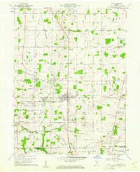
1960 Map of Lynn
USGS Topo · Published 1976About this map
The railroad junction at Lynn serves as the focal point for this eastern Indiana landscape during the early 1960s. Both the Pennsylvania and the New York Central railroads intersect here, driving the development of this rural region. The map captures a detailed network of small agricultural settlements and hamlets like Bloomingport, Rural, and Snow Hill connected by a dense system of country roads and drainage features such as the Hinshall Ditch and Kelly Ditch.
Find a feature on this map
52 named features on this map. Tap any name to fly to it.
Don’t see what you’re looking for? This feature index may not catch every label — zoom into the map to look around manually.
Map Details
Editions of this 1960 Lynn Map
4 editions found
Other maps of this area

1915 · New Paris
USGS Topo · 1:48,000

1916 · Winchester
USGS Topo · 1:48,000

1918 · Winchester
USGS Topo · 1:62,500

1918 · New Paris
USGS Topo · 1:62,500

1943 · Winchester
USGS Topo · 1:62,500

1952 · Maxville
USGS Topo · 1:24,000

1953 · Cincinnati
USGS Topo · 1:250,000

1953 · Muncie
USGS Topo · 1:250,000

1956 · Muncie
USGS Topo · 1:250,000

1957 · Cincinnati
USGS Topo · 1:250,000