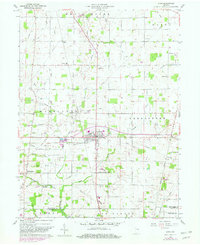
1960 Map of Lynn
USGS Topo · Published 1982About this map
The town of Lynn serves as the central hub for this east-central Indiana landscape, where a dense network of watercourses like Greens Fork and Mud Run define the agricultural drainage of Randolph and Wayne Counties. The map reveals a settled rural landscape dotted with local gathering points, including the New Liberty Ch and Pleasant Valley Ch. Significant for family history, several burial grounds are scattered throughout the townships, such as Mt Pleasant Cem and the Quaker Lynn Cem south of the main settlement.
Find a feature on this map
51 named features on this map. Tap any name to fly to it.
Don’t see what you’re looking for? This feature index may not catch every label — zoom into the map to look around manually.
Map Details
Editions of this 1960 Lynn Map
4 editions found
Other maps of this area

1915 · New Paris
USGS Topo · 1:48,000

1916 · Winchester
USGS Topo · 1:48,000

1918 · Winchester
USGS Topo · 1:62,500

1918 · New Paris
USGS Topo · 1:62,500

1943 · Winchester
USGS Topo · 1:62,500

1952 · Maxville
USGS Topo · 1:24,000

1953 · Cincinnati
USGS Topo · 1:250,000

1953 · Muncie
USGS Topo · 1:250,000

1956 · Muncie
USGS Topo · 1:250,000

1957 · Cincinnati
USGS Topo · 1:250,000