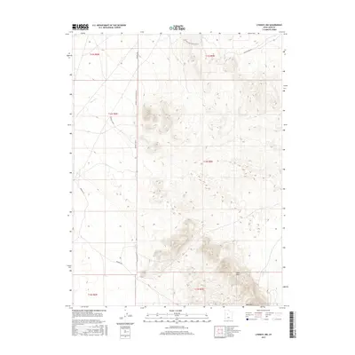
2017 Map of Lynndyl NW
USGS Topo · Published 2017About this map
Sand Mtn and the surrounding high desert terrain define this corner of Juab County, captured in detail during a 2017 survey. The landscape is characterized by its dramatic shifts in elevation, where the drainage of Cherry Creek cuts through the northwest while the massive dunes of the Sand Hills dominate the southern reach. The map reveals a network of primitive and secondary tracks essential for local navigation, including Windmill Rd, Telephone Rd, and Oscarthorpe Rd. This specific grid of township and range lines, such as t13s r5w, reflects the enduring legacy of the Public Land Survey System in organizing this arid landscape. The naming of routes like Backside Sand Mountain Rd and Left Fork Sand Mountain Rd highlights the topographical prominence of the mountain as a central landmark for both travel and geographic orientation in the region.
Find a feature on this map
16 named features on this map. Tap any name to fly to it.
Don’t see what you’re looking for? This feature index may not catch every label — zoom into the map to look around manually.
Map Details
Editions of this 2017 Lynndyl NW Map
This is the sole edition of this map. No revisions or reprints were ever made.
Other maps of this area

1885 · Sevier Desert
USGS Topo · 1:250,000

1953 · Delta
USGS Topo · 1:250,000

1958 · Delta
USGS Topo · 1:250,000

1962 · Delta
USGS Topo · 1:250,000

1962 · Lynndyl
USGS Topo · 1:62,500

1963 · Maple Peak
USGS Topo · 1:24,000

1963 · Cherry Creek
USGS Topo · 1:24,000

1971 · Rain Lake
USGS Topo · 1:24,000

1971 · Desert Mtn Pass
USGS Topo · 1:24,000
1971 · Desert Mtn Reservoir
USGS Topo · 1:24,000