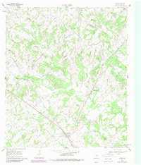
1960 Map of Lyons
USGS Topo · Published 1989About this map
The town of Lyons and the surrounding drainage of Davidson Creek define this rural landscape in Burleson County during the mid-twentieth century. Settlement patterns follow the elevated ground between the creek bottoms, with small communities and family-named cemeteries scattered across the terrain. Genealogists will find a wealth of local landmarks, including the Pillow Cem, High Prairie Cem, and Lawrence Cem, which reflect the area's agricultural heritage. Small-scale industry is represented by a Gravel Pit and a prominent Pipeline corridor that cuts across the land. The presence of Lone Oak Ch and Center Line indicates a community structured around rural intersections and watercourses like Sandy Creek and Berry Creek. This survey captures the region as it transitioned with updated woodland data from the early 1980s, providing a layered look at the changing vegetation patterns near Rough Bayou.
Find a feature on this map
17 named features on this map. Tap any name to fly to it.
Don’t see what you’re looking for? This feature index may not catch every label — zoom into the map to look around manually.
Map Details
Editions of this 1960 Lyons Map
2 editions found
Other maps of this area

1914 · Gay Hill
USGS Topo · 1:62,500

1954 · Austin
USGS Topo · 1:250,000

1956 · Bryan
USGS Topo · 1:62,500

1956 · Caldwell
USGS Topo · 1:62,500

1956 · Somerville
USGS Topo · 1:62,500

1959 · Flag Pond
USGS Topo · 1:24,000

1959 · Gay Hill
USGS Topo · 1:24,000

1959 · Somerville
USGS Topo · 1:24,000

1960 · Lyons
USGS Topo · 1:24,000
1960 · Snook
USGS Topo · 1:24,000