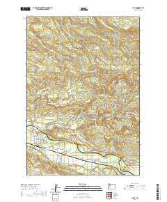
2020 Map of Lyons
USGS Topo · Published 2020About this map
The North Santiam River serves as the dividing line between Marion and Linn Counties, anchoring the community of Lyons and the surrounding basin. This landscape is defined by its deep vertical relief and complex hydrology, where numerous tributaries descend from high elevations to feed the larger river system. The settlement of Fox Valley sits south of the river, marked by the Fox Valley Cem and agricultural lands that contrast with the densely forested ridges to the north and west.
Find a feature on this map
88 named features on this map. Tap any name to fly to it.
Don’t see what you’re looking for? This feature index may not catch every label — zoom into the map to look around manually.
Map Details
Editions of this 2020 Lyons Map
This is the sole edition of this map. No revisions or reprints were ever made.
Other maps of this area

1929 · Mill City
USGS Topo · 1:125,000

1951 · Lyons
USGS Topo · 1:62,500

1951 · Snow Peak
USGS Topo · 1:62,500

1953 · Salem
USGS Topo · 1:250,000

1954 · Salem
USGS Topo · 1:250,000

1955 · Mill City
USGS Topo · 1:62,500

1956 · Quartzville
USGS Topo · 1:62,500

1960 · Salem
USGS Topo · 1:250,000

1962 · Salem
USGS Topo · 1:250,000

1963 · Salem
USGS Topo · 1:250,000