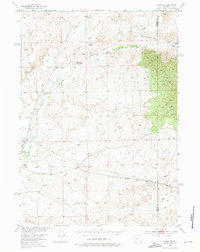
1952 Map of Lysite SE
USGS Topo · Published 1976About this map
Isolated homesteads and industrial infrastructure dot this central Wyoming landscape during the early 1950s. The map captures a rugged basin defined by the winding courses of Badwater Creek and the South Fork, where the arid terrain necessitated the construction of an extensive system of Ditch lines and Flume segments to manage water resources. Ranching life is evidenced by family landmarks like Allen Ranch, Lybyer Ranch, and Bauer Ranch, which are connected by primitive routes such as No Wood Road.
Find a feature on this map
21 named features on this map. Tap any name to fly to it.
Don’t see what you’re looking for? This feature index may not catch every label — zoom into the map to look around manually.
Map Details
Editions of this 1952 Lysite SE Map
2 editions found
Other maps of this area

1952 · Cottonwood Pass
USGS Topo · 1:24,000

1952 · Moneta
USGS Topo · 1:24,000

1952 · Badwater
USGS Topo · 1:24,000

1952 · Lysite
USGS Topo · 1:24,000

1952 · Madden
USGS Topo · 1:24,000

1952 · Arminto NW
USGS Topo · 1:24,000

1952 · Lysite SE
USGS Topo · 1:24,000

1952 · Sioux Pass
USGS Topo · 1:24,000

1952 · Arapahoe Butte
USGS Topo · 1:24,000

1955 · Arminto
USGS Topo · 1:250,000