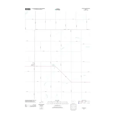
2013 Map of Lytton
USGS Topo · Published 2013About this map
Lytton sits as the primary settlement within this agricultural landscape, defined by a rigid grid of rural roads and the meandering paths of local waterways. The town's layout includes established thoroughfares such as 2nd St and 3rd St, which intersect near the heart of the community. Beyond the residential clusters, the terrain is shaped by the W Fork Camp Cr and Camp Cr, which weave through the surrounding farmland. The presence of Drainage Ditch 6 in the eastern portion of the quadrangle indicates the sophisticated water management systems required to support intensive prairie cultivation. This 2013 survey provides a clear view of the modern rural infrastructure, where significant county routes like Co Hwy-D26 connect remote farmsteads to the regional transportation network.
Find a feature on this map
31 named features on this map. Tap any name to fly to it.
Don’t see what you’re looking for? This feature index may not catch every label — zoom into the map to look around manually.
Map Details
Editions of this 2013 Lytton Map
This is the sole edition of this map. No revisions or reprints were ever made.
Other maps of this area

1954 · Fort Dodge
USGS Topo · 1:250,000

1957 · Fort Dodge
USGS Topo · 1:250,000

1958 · Fort Dodge
USGS Topo · 1:250,000

1979 · Fonda
USGS Topo · 1:24,000

1979 · Pomeroy
USGS Topo · 1:24,000

1979 · Newell East
USGS Topo · 1:24,000

1980 · Lytton
USGS Topo · 1:24,000

1980 · Rockwell City
USGS Topo · 1:24,000

1980 · Sac City East
USGS Topo · 1:24,000

1980 · Grant City
USGS Topo · 1:24,000