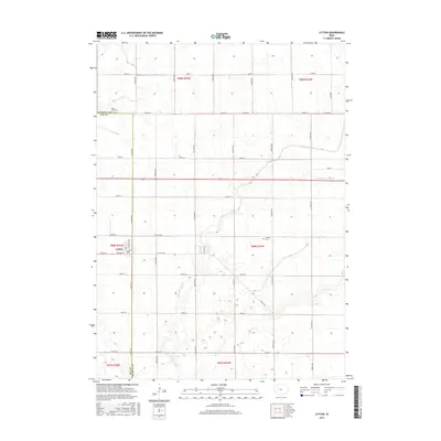
2015 Map of Lytton
USGS Topo · Published 2015About this map
Lytton sits at the intersection of the Sac Co and Calhoun Co line, serving as a primary hub for this agricultural landscape during the mid-2010s. The town's grid is anchored by Main ST and Railway St, reflecting the historical importance of the rail corridor to the local grain economy. Surrounding the settlement, the terrain is defined by the headwaters of W Fork Camp Cr and Camp Cr, which meander through a highly engineered drainage network including Drainage Ditch 6. The rural sections are marked by established landmarks such as Saint John Cem in the northwest and Garfield Cem further east, providing vital reference points for genealogists tracking families across the townships of t88n r34w and t89n r34w. A dense network of county roads, such as Co HWY n28 and Co RD d26, illustrates the persistent section-line development that characterizes the region's farming heritage.
Find a feature on this map
46 named features on this map. Tap any name to fly to it.
Don’t see what you’re looking for? This feature index may not catch every label — zoom into the map to look around manually.
Map Details
Editions of this 2015 Lytton Map
This is the sole edition of this map. No revisions or reprints were ever made.
Other maps of this area

1954 · Fort Dodge
USGS Topo · 1:250,000

1957 · Fort Dodge
USGS Topo · 1:250,000

1958 · Fort Dodge
USGS Topo · 1:250,000

1979 · Fonda
USGS Topo · 1:24,000

1979 · Pomeroy
USGS Topo · 1:24,000

1979 · Newell East
USGS Topo · 1:24,000

1980 · Lytton
USGS Topo · 1:24,000

1980 · Rockwell City
USGS Topo · 1:24,000

1980 · Sac City East
USGS Topo · 1:24,000

1980 · Grant City
USGS Topo · 1:24,000