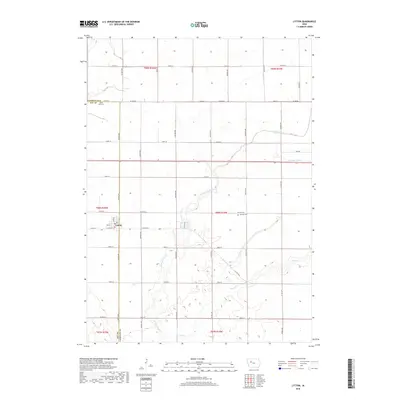
2018 Map of Lytton
USGS Topo · Published 2018About this map
The town of Lytton straddles the county line between Sac and Calhoun counties, serving as a hub for the surrounding agricultural prairie. This 2018 survey shows a landscape defined by the rigid grid of the Public Land Survey System, where section lines dictate the paths of numerous rural roads like Co Hwy D33 and Dakota Ave. The hydrology of the region is characterized by natural watercourses like Camp Cr and the W Fork Camp Cr, supplemented by managed infrastructure such as Drainage Ditch 6 to support the local farming economy. Within the town limits, names like Railway St reflect the historical influence of transportation networks on local development. Two primary cemeteries, Saint John Cem and Garfield Cem, are documented here, providing important anchor points for family historians and genealogists researching the residents of these rural townships.
Find a feature on this map
45 named features on this map. Tap any name to fly to it.
Don’t see what you’re looking for? This feature index may not catch every label — zoom into the map to look around manually.
Map Details
Editions of this 2018 Lytton Map
This is the sole edition of this map. No revisions or reprints were ever made.
Other maps of this area

1954 · Fort Dodge
USGS Topo · 1:250,000

1957 · Fort Dodge
USGS Topo · 1:250,000

1958 · Fort Dodge
USGS Topo · 1:250,000

1979 · Fonda
USGS Topo · 1:24,000

1979 · Pomeroy
USGS Topo · 1:24,000

1979 · Newell East
USGS Topo · 1:24,000

1980 · Lytton
USGS Topo · 1:24,000

1980 · Rockwell City
USGS Topo · 1:24,000

1980 · Sac City East
USGS Topo · 1:24,000

1980 · Grant City
USGS Topo · 1:24,000