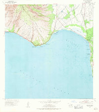
1954 Map of Maalaea
USGS Topo · Published 1971About this map
Maalaea Bay is defined by the steep transitions from the West Maui Forest Reserve down to the shallow waters of the south shore. During this mid-century period, the landscape reflects a mix of maritime activity and emerging aviation, centered around the Maalaea Small Boat Harbor and the Maui Airport (Puunene Airport). Agricultural infrastructure, including the Waihee Ditch and Waikapu Ditch, segments the coastal plains where the Waikapu Stream feeds into the expansive Kealia Pond. Along the eastern shoreline, the small settlements of Kihei, Kalepolepo, and Laie follow the Kihei Road, while landmarks like the WWVH Radio Tower and Maipoina Oe Iau Beach Park mark the recreational and communication hubs of the era. The topography of the west is dominated by numerous gulches, such as Pohakea Gulch and Ukumehame Gulch, which carve through Kealaloloa Ridge toward the rocky points of McGregor Point and Papawai Point.
Find a feature on this map
62 named features on this map. Tap any name to fly to it.
Don’t see what you’re looking for? This feature index may not catch every label — zoom into the map to look around manually.
Map Details
Editions of this 1954 Maalaea Map
2 editions found
Other maps of this area

1929 · Kahoolawe
USGS Topo · 1:62,500

1954 · Maui
USGS Topo · 1:250,000

1954 · Maalaea
USGS Topo · 1:24,000

1954 · Paia
USGS Topo · 1:24,000

1954 · Puu O Kali
USGS Topo · 1:24,000

1954 · Makena
USGS Topo · 1:24,000

1955 · Olowalu
USGS Topo · 1:24,000

1955 · Wailuku
USGS Topo · 1:24,000

1956 · Lahaina
USGS Topo · 1:24,000

1966 · Maui
USGS Topo · 1:250,000