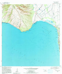
1983 Map of Maalaea
USGS Topo · Published 1991About this map
Maalaea Bay dominates this southern Maui coastline, where the rugged descent of the West Maui Forest Reserve meets the isthmus. The landscape is defined by the sharp transition from the steep, gulch-cut ridges of Pohakea Ridge and Kealaloloa Ridge to the low-lying wetlands of Kealia Pond. Human activity is concentrated along the shore, notably at the Maalaea Small Boat Harbor and the growing settlement of Kihei to the east.
Find a feature on this map
54 named features on this map. Tap any name to fly to it.
Don’t see what you’re looking for? This feature index may not catch every label — zoom into the map to look around manually.
Map Details
Editions of this 1983 Maalaea Map
2 editions found
Other maps of this area

1929 · Kahoolawe
USGS Topo · 1:62,500

1954 · Maui
USGS Topo · 1:250,000

1954 · Maalaea
USGS Topo · 1:24,000

1954 · Paia
USGS Topo · 1:24,000

1954 · Puu O Kali
USGS Topo · 1:24,000

1954 · Makena
USGS Topo · 1:24,000

1955 · Olowalu
USGS Topo · 1:24,000

1955 · Wailuku
USGS Topo · 1:24,000

1956 · Lahaina
USGS Topo · 1:24,000

1966 · Maui
USGS Topo · 1:250,000