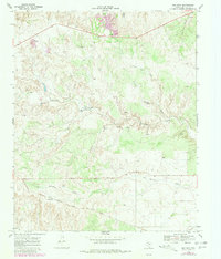
1968 Map of Mac Bain
USGS Topo · Published 1981About this map
Quanah Acme And Pacific tracks run through the southern portion of this West Texas landscape, serving the small settlement of Mac Bain. The terrain is defined by a complex network of ephemeral drainages and springs, including the prominent Dutchman Creek and its namesake settlement, Dutchman. Numerous named water features like Wason Spring and Dropping Springs suggest the critical importance of water sources in this arid region of Motley County during the late 1960s. The survey also captures the local infrastructure of the era, from a Radio Tower to several Gravel Pits, alongside extensive draws such as Shinnery Draw and Carter Draw that carve through the plains.
Find a feature on this map
18 named features on this map. Tap any name to fly to it.
Don’t see what you’re looking for? This feature index may not catch every label — zoom into the map to look around manually.
Map Details
Editions of this 1968 Mac Bain Map
2 editions found
Other maps of this area

1954 · Lubbock
USGS Topo · 1:250,000

1954 · Plainview
USGS Topo · 1:250,000

1958 · Plainview
USGS Topo · 1:250,000

1965 · Wake
USGS Topo · 1:24,000

1966 · Matador
USGS Topo · 1:24,000

1967 · Dick Moore Canyon
USGS Topo · 1:24,000

1967 · Whiteflat
USGS Topo · 1:24,000

1968 · Mac Bain
USGS Topo · 1:24,000

1968 · Roaring Springs
USGS Topo · 1:24,000

1968 · Rustler Camp
USGS Topo · 1:24,000