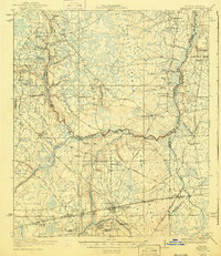
1918 Map of Macclenny
USGS Topo · Published 1940About this map
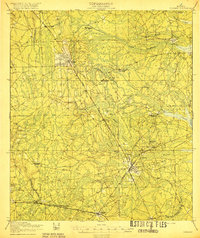
Macclenny and its surrounding timber and agricultural lands are shown here as they were surveyed in 1917. The landscape is defined by the prominent Trail Ridge and the complex drainage of the St Marys River, with its North, Middle, and South Prongs creating a natural border between Florida and Georgia. This era reveals a network of rural schoolhouses and churches that served as community hubs, including Chism School, Macedon Church, and Hicks Church. The agricultural character of the region is evident through specialized sites such as Suggs Still, Griffin Nursery, and the Glen St Mary Nursery. Transportation is anchored by the Seaboard Air Line and the Georgia and Florida RR, which facilitated movement through the pine woods and across the river at Smith Bridge and Stokes Bridge.
Find a feature on this map
73 named features on this map. Tap any name to fly to it.
Don’t see what you’re looking for? This feature index may not catch every label — zoom into the map to look around manually.
Map Details
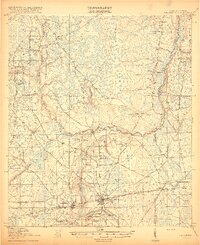
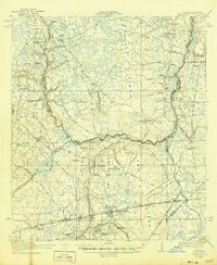
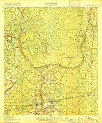
Editions of this 1918 Macclenny Map
4 editions found
Other maps of this area

1917 · Cambon
USGS Topo · 1:62,500

1917 · Macclenny
USGS Topo · 1:62,500

1917 · Hilliard
USGS Topo · 1:62,500

1918 · Middleburg
USGS Topo · 1:62,500

1918 · Moniac
USGS Topo · 1:62,500

1918 · Lawtey
USGS Topo · 1:62,500

1918 · Cambon
USGS Topo · 1:62,500
1918 · Macclenny
USGS Topo · 1:62,500
1919 · Hilliard
USGS Topo · 1:62,500

1941 · Middleburg
USGS Topo · 1:62,500