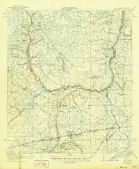
1918 Map of Macclenny
USGS Topo · Published 1946About this map
Macclenny and the surrounding pine flatwoods of Baker County appear here as they were surveyed just before the end of the Great War. The landscape is defined by the prominent Trail Ridge and the winding course of the St Marys River, which serves as the boundary between Georgia and Florida. This era shows a region built on timber and transport, evidenced by local operations like Suggs Still and Bryces Camp.
Find a feature on this map
74 named features on this map. Tap any name to fly to it.
Don’t see what you’re looking for? This feature index may not catch every label — zoom into the map to look around manually.
Map Details
Editions of this 1918 Macclenny Map
4 editions found
Other maps of this area

1917 · Cambon
USGS Topo · 1:62,500

1917 · Macclenny
USGS Topo · 1:62,500

1917 · Hilliard
USGS Topo · 1:62,500

1918 · Middleburg
USGS Topo · 1:62,500

1918 · Moniac
USGS Topo · 1:62,500

1918 · Lawtey
USGS Topo · 1:62,500

1918 · Cambon
USGS Topo · 1:62,500

1918 · Macclenny
USGS Topo · 1:62,500

1919 · Hilliard
USGS Topo · 1:62,500

1941 · Middleburg
USGS Topo · 1:62,500