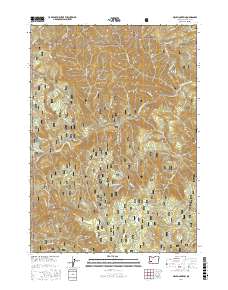
2017 Map of Mace Mountain
USGS Topo · Published 2017About this map
Umpqua National Forest defines the steep drainage basins of the North Umpqua River and its numerous tributaries in this 2017 survey. The landscape is marked by extreme vertical relief, from the heights of Mace Mountain and Blitzen Butte down to the river valley where the Highway 138 corridor provides the primary access. This modern survey illustrates the complex network of National Forest development roads and timber-related trails, such as Pup Thin Ts and Fox-Rumble Ts, which carve through the dense terrain to reach remote high points like Thunder Mtn. Geologic landmarks and water features are prominent, including the distinctive Cougar Bluffs and waterfalls such as Grotto Falls and Emile Falls near the southern boundary. The map serves as a detailed record of land management and forest access in Douglas County's backcountry.
Find a feature on this map
72 named features on this map. Tap any name to fly to it.
Don’t see what you’re looking for? This feature index may not catch every label — zoom into the map to look around manually.
Map Details
Editions of this 2017 Mace Mountain Map
This is the sole edition of this map. No revisions or reprints were ever made.
Other maps of this area

1955 · Quartz Mtn
USGS Topo · 1:62,500

1955 · Red Butte
USGS Topo · 1:62,500

1955 · Mace Mtn
USGS Topo · 1:62,500

1955 · Illahee Rock
USGS Topo · 1:62,500

1958 · Roseburg
USGS Topo · 1:250,000

1959 · Roseburg
USGS Topo · 1:250,000

1978 · Diamond Lake
USGS Topo · 1:100,000
1989 · Taft Mountain
USGS Topo · 1:24,000
1989 · Scaredman Creek
USGS Topo · 1:24,000
1989 · Old Fairview
USGS Topo · 1:24,000