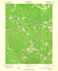
1964 Map of Macfarlan
USGS Topo · Published 1966About this map
Extensive oil and gas extraction across the Oil Field defines this West Virginia landscape, where the South Fork Hughes River snakes through the narrow valleys of Murphy and Grant. The settlement of Macfarlan serves as a central point along the river, while smaller communities like Beatrice and Brohard are tucked into the steep hillsides at the junction of Ritchie, Wirt, and Calhoun counties. The area’s spiritual and social center is found in numerous rural landmarks, including Deem Chapel, Mt Zion Ch, and the Hartley Sch.
Find a feature on this map
53 named features on this map. Tap any name to fly to it.
Don’t see what you’re looking for? This feature index may not catch every label — zoom into the map to look around manually.
Map Details
Editions of this 1964 Macfarlan Map
3 editions found
Other maps of this area

1906 · Elizabeth
USGS Topo · 1:62,500

1907 · Harrisville
USGS Topo · 1:62,500

1907 · Arnoldsburg
USGS Topo · 1:62,500

1907 · Spencer
USGS Topo · 1:62,500

1924 · Harrisville
USGS Topo · 1:62,500

1924 · Elizabeth
USGS Topo · 1:62,500

1925 · Arnoldsburg
USGS Topo · 1:62,500

1926 · Elizabeth
USGS Topo · 1:62,500

1926 · Harrisville
USGS Topo · 1:62,500

1927 · Arnoldsburg
USGS Topo · 1:62,500