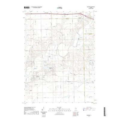
2021 Map of Mackinaw
USGS Topo · Published 2021About this map
The Mackinaw River and its tributary, the Little Mackinaw River, carve a distinct path through this section of central Illinois, where the boundaries of Woodford, McLean, and Tazewell counties converge. The village of Mackinaw anchors the southwest, situated near a series of crossings including Stout Bridge and Porter Bridge. The landscape is defined by its agricultural grid, yet punctuated by numerous small burial grounds that speak to the area's early settlement history, such as Stumbaugh Cem, Hardscrabble Cem, and Bergen Cem. Development patterns vary from the established streets of Deer Creek and Goodfield in the north to the more modern residential layout around Heritage Lake. Water features like Spin Lake and Le Baube Lake contrast with the natural flow of Sargent Slough and Mud Cr, while Weishaupt Airport provides a small aviation footprint amidst the farms.
Find a feature on this map
135 named features on this map. Tap any name to fly to it.
Don’t see what you’re looking for? This feature index may not catch every label — zoom into the map to look around manually.
Map Details
Editions of this 2021 Mackinaw Map
This is the sole edition of this map. No revisions or reprints were ever made.
Other maps of this area

1927 · Danvers
USGS Topo · 1:62,500

1928 · Mackinaw
USGS Topo · 1:62,500

1930 · Danvers
USGS Topo · 1:62,500

1932 · Mackinaw
USGS Topo · 1:62,500

1949 · Mc Lean
USGS Topo · 1:62,500

1951 · McLean
USGS Topo · 1:62,500

1951 · Minier
USGS Topo · 1:62,500

1958 · Peoria
USGS Topo · 1:250,000

1961 · Peoria
USGS Topo · 1:250,000

1963 · Peoria
USGS Topo · 1:250,000