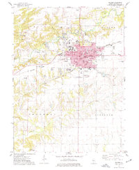
1974 Map of Macomb
USGS Topo · Published 1977About this map
Western Illinois University serves as a prominent anchor for the city of Macomb in the mid-1970s, as depicted in this topographical study. The city's grid is firmly established around the Courthouse and City Hall, with the Burlington Northern railroad slicing through the heart of the settlement. The landscape beyond the urban center transitions into the surrounding townships of Emmet, Chalmers, and Scotland, where the drainage of the East Fork La Moine River and Troublesome Creek carves a complex topography of ridges and hollows like Wigwam Hollow.
Find a feature on this map
61 named features on this map. Tap any name to fly to it.
Don’t see what you’re looking for? This feature index may not catch every label — zoom into the map to look around manually.
Map Details
Editions of this 1974 Macomb Map
3 editions found
Other maps of this area

1912 · Macomb
USGS Topo · 1:62,500

1913 · Colchester
USGS Topo · 1:62,500

1914 · Macomb
USGS Topo · 1:62,500

1916 · Good Hope
USGS Topo · 1:62,500

1918 · La Harpe
USGS Topo · 1:62,500

1918 · Good Hope
USGS Topo · 1:62,500

1958 · Burlington
USGS Topo · 1:250,000

1961 · Burlington
USGS Topo · 1:250,000

1963 · Burlington
USGS Topo · 1:250,000
1974 · Doddsville
USGS Topo · 1:24,000