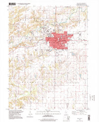
1997 Map of Macomb
USGS Topo · Published 1999About this map
The Western Illinois University campus and the surrounding city of Macomb dominate this late-century landscape at the confluence of the La Moine River and its various forks. The map reveals the intricate urban grid of the county seat, centered on the Courthouse, City Hall, and Post Office, while following the expansion of residential streets like Pierce St and Adams St. Beyond the urban core, the terrain is defined by its numerous rural burying grounds, including Simpson Cem to the north and the clustered Strader Cem and Wayland Cem in the southwest corner.
Find a feature on this map
53 named features on this map. Tap any name to fly to it.
Don’t see what you’re looking for? This feature index may not catch every label — zoom into the map to look around manually.
Map Details
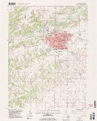
Editions of this 1997 Macomb Map
2 editions found
Other maps of this area

1912 · Macomb
USGS Topo · 1:62,500

1913 · Colchester
USGS Topo · 1:62,500

1914 · Macomb
USGS Topo · 1:62,500

1916 · Good Hope
USGS Topo · 1:62,500

1918 · La Harpe
USGS Topo · 1:62,500

1918 · Good Hope
USGS Topo · 1:62,500

1958 · Burlington
USGS Topo · 1:250,000

1961 · Burlington
USGS Topo · 1:250,000

1963 · Burlington
USGS Topo · 1:250,000
1974 · Doddsville
USGS Topo · 1:24,000