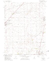
1982 Map of Macon West
USGS Topo · Published 1983About this map
The agricultural heartland where Macon Co, Christian Co, and Shelby Co converge is defined by a dense network of family cemeteries and township boundaries. The village of Blue Mound anchors the western edge, while the larger settlement of Macon and the northern reaches of Moweaqua mark the eastern and southern perimeters. The landscape is structured by two major rail lines: the Norfolk and Western running through the northwest and the Illinois Central Gulf traversing the east. Rural life centers on landmarks like Bethel Ch and the Willow Branch County Conservation Area. For genealogists, this 1982 map is an invaluable record of the region's burial grounds, including South Macon Cem, Pleasant View Cem, Adams Cem, and the Bilyeu Cem, offering precise locations for ancestral research in these three interlocking counties.
Find a feature on this map
41 named features on this map. Tap any name to fly to it.
Don’t see what you’re looking for? This feature index may not catch every label — zoom into the map to look around manually.
Map Details
Editions of this 1982 Macon West Map
2 editions found
Other maps of this area

1929 · Decatur
USGS Topo · 1:62,500

1933 · Decatur
USGS Topo · 1:62,500

1949 · Dalton City
USGS Topo · 1:62,500

1952 · Assumption
USGS Topo · 1:62,500

1954 · Niantic
USGS Topo · 1:62,500

1958 · Decatur
USGS Topo · 1:250,000

1961 · Decatur
USGS Topo · 1:250,000

1967 · Decatur
USGS Topo · 1:24,000

1974 · Willeys
USGS Topo · 1:24,000

1982 · Harristown
USGS Topo · 1:24,000