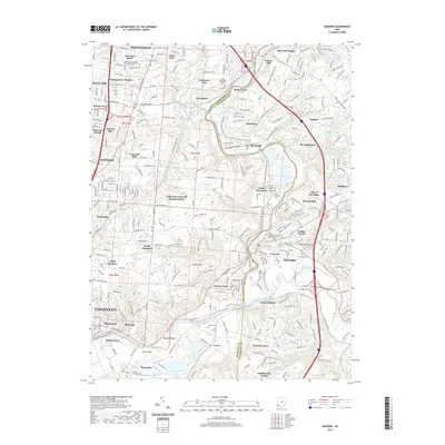
2019 Map of Madeira
USGS Topo · Published 2019About this map
The Little Miami River creates a natural boundary as it winds through this portion of Hamilton and Clermont counties, anchoring a network of historic settlements like Miamiville and Camp Dennison. The landscape is a complex blend of residential development and preserved green spaces, including Laurel Memorial Gardens and Lake Isabella. Genealogists will find a high density of burial sites across the quadrangle, from the United Jewish Cem Montgomery Cem in the northwest to the Milford Independent Order of Oddfellows Cem and Greenlawn Cem near Milford. Notable geographic markers such as Spooky Hollow and Bass Island underscore the area's varied topography, while the Indian Hill & Railroad and a Gravel Pit near Ancor point to the region's historical industrial and transit corridors.
Find a feature on this map
307 named features on this map. Tap any name to fly to it.
Don’t see what you’re looking for? This feature index may not catch every label — zoom into the map to look around manually.
Map Details
Editions of this 2019 Madeira Map
This is the sole edition of this map. No revisions or reprints were ever made.
Other maps of this area

1898 · East Cincinnati
USGS Topo · 1:62,500

1904 · Mason
USGS Topo · 1:62,500

1906 · Mason
USGS Topo · 1:62,500

1914 · East Cincinnati
USGS Topo · 1:62,500

1914 · Batavia
USGS Topo · 1:48,000

1914 · Morrow
USGS Topo · 1:62,500

1916 · Batavia
USGS Topo · 1:62,500

1916 · Morrow
USGS Topo · 1:62,500

1952 · Newport
USGS Topo · 1:24,000

1953 · Withamsville
USGS Topo · 1:24,000