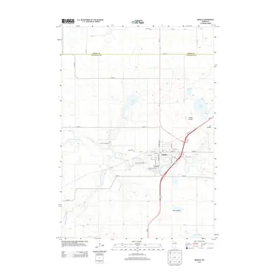
2013 Map of Madelia
USGS Topo · Published 2013About this map
Madelia sits at the heart of this landscape where the Watonwan River and its S Fork Watonwan River converge. The town's layout is well-documented, featuring a Po and the Madelia Golf Course, while the nearby Warren Truss Bridge spans the water. To the east and south, the terrain is defined by large depressions including Goose Lakebed, Lau Lakebed, and Hopkins Lakebed, suggesting a history of seasonal wetlands or former water bodies in this part of Watonwan County. Genealogists will find a significant concentration of burial sites surrounding the main settlement, including Madelia Cem, Riverside Cem, and Calvary Cem, along with rural outliers like Linden Cem near the northern border with Brown County and the Old Faith Lutheran Cem to the west. This 2013 survey provides a detailed view of the local infrastructure and the natural drainage patterns of Spring Brook and Elm Cr that shape the region's geography.
Find a feature on this map
52 named features on this map. Tap any name to fly to it.
Don’t see what you’re looking for? This feature index may not catch every label — zoom into the map to look around manually.
Map Details
Editions of this 2013 Madelia Map
This is the sole edition of this map. No revisions or reprints were ever made.
Other maps of this area

1953 · New Ulm
USGS Topo · 1:250,000

1954 · Fairmont
USGS Topo · 1:250,000

1957 · New Ulm
USGS Topo · 1:250,000

1958 · New Ulm
USGS Topo · 1:250,000

1958 · Fairmont
USGS Topo · 1:250,000

1965 · Madelia
USGS Topo · 1:24,000

1965 · Hanska
USGS Topo · 1:24,000

1965 · Perth
USGS Topo · 1:24,000

1965 · Cambria
USGS Topo · 1:24,000

1967 · New Ulm
USGS Topo · 1:250,000