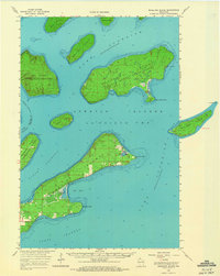
1964 Map of Madeline Island
USGS Topo · Published 1966About this map
Madeline Island and its neighbors in the Apostle Islands archipelago are captured here during the mid-1960s, prior to the official establishment of the national lakeshore. The map provides a detailed view of La Pointe TWP and the Apostle Islands State Forest, revealing a landscape shaped by both natural wonders and early industry. Features like Quarry Point on Stockton Island and the Quarry on Hermit Island indicate the historical importance of the region's brownstone resources. Along the shores of Lake Superior, family and community history is marked by landmarks such as Greenwood Cem near Chebomnicon Bay, and distinctive geological formations like Devils Cauldron and Balancing Rock. The charting of various channels—North Channel, South Channel, and West Channel—underscores the maritime character of this Wisconsin island chain.
Find a feature on this map
35 named features on this map. Tap any name to fly to it.
Don’t see what you’re looking for? This feature index may not catch every label — zoom into the map to look around manually.
Map Details
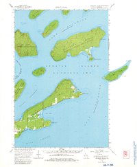
Editions of this 1964 Madeline Island Map
2 editions found
Other maps of this area

1941 · Bayfield
USGS Topo · 1:48,000

1942 · Ashland
USGS Topo · 1:48,000

1943 · Little Girl Point
USGS Topo · 1:48,000

1943 · Odanah
USGS Topo · 1:48,000

1945 · Odanah
USGS Topo · 1:48,000

1946 · Bayfield
USGS Topo · 1:48,000

1947 · Ashland
USGS Topo · 1:48,000

1953 · Ashland
USGS Topo · 1:250,000

1954 · Two Harbors
USGS Topo · 1:250,000
1956 · Little Girls Point
USGS Topo · 1:62,500